line decor


Web hosting donated by Colorado Firecamp.

Chaffee County, Colorado
  

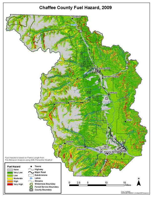
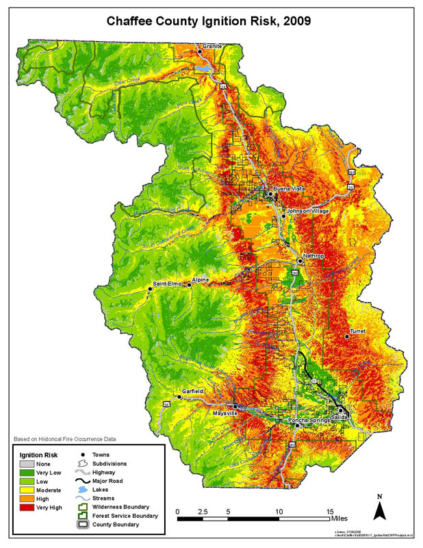
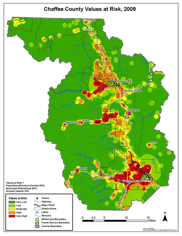
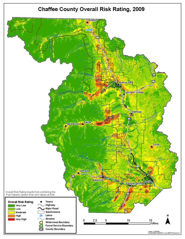
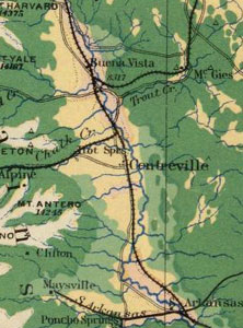
Chaffee County Wildfire Hazard Maps

Analysis diagram explaining relationg of overall risk rating to fuel hazard, ignition risk and values at risk.


Fuel Hazard

Chaffee County CWPP Fuel Hazard Map.  Fuel hazard is based on flame length from fire behavior analysis using 90th percentile weather.


Chaffee County Ignition Risk

Chaffee County CWPP Ignition Risk Map, based on historical fire occurrence data.


Chaffee County Values at Risk

Chaffee County CWPP Values at Risk  Map, weighted for population/structure density, 65%; municipal watersheds, 20%; and erosion hazard, 15%.


Overall Risk Rating

Chaffee County CWPP Overall Risk Rating Map. Overall risk rating results from combining the fuel hazard, ignition risk, and values at risk.